Walks from the campsite
Short and long walks starting from the campsite…
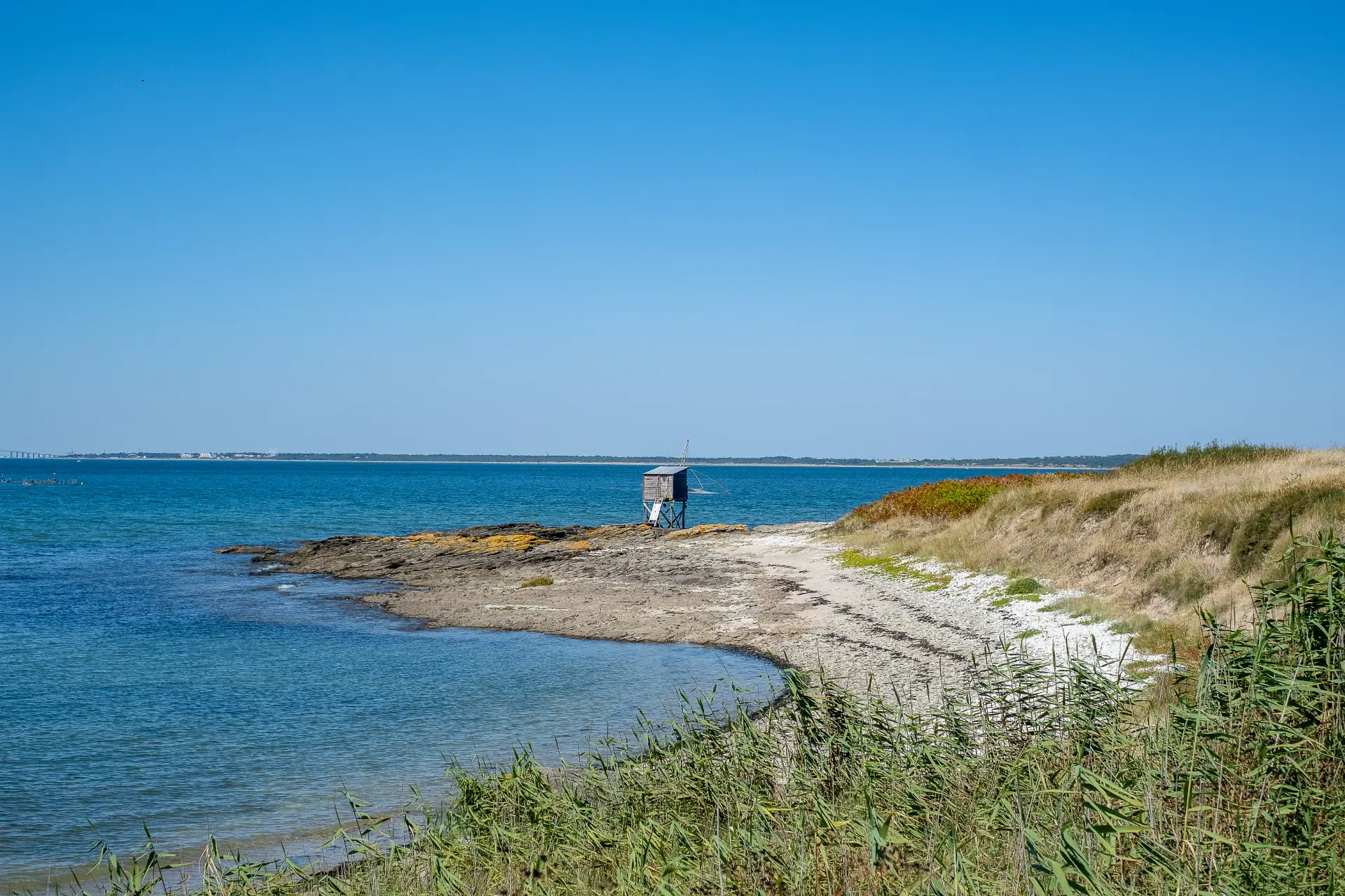
From your pitch, you’ll have direct access to a cycle path that runs behind the campsite (a blue gate at the back of the campsite leads to the Chemin des Prés Communs). Turn left to reach the Port de la Gravette (300m), the Plage de la Tara (swimming) or the Plage du Mouton (fishing). You can continue on to Pointe Saint-Gildas via the coastal path (on foot only), where you’ll find a sailing school, a jet ski base, a museum housed in the old semaphore (a strategic viewpoint over the ocean), and restaurants for a well-deserved break! Along the way, you’ll discover the analemmatic sundial (between La Tara and La Prée) and, a little further on, an orientation table providing a wealth of information on the history of the Pays de Retz, navigation in the estuary, shipbuilding, shipwrecks, marine cultures, beaches…
As far as Pornic, you’ll discover one of the longest and wildest stretches of the Douaniers trail – GR8 (creeks, cliffs, views over Noirmoutier…), crossing Préfailles and Sainte Marie, but if you’ve got good shoes, good calves and a craving for the sea air it extends as far as La Bernerie and Les Moutiers-en-Retz!
On the other side, you can reach the village of La Plaine via cycle paths through the fields (approx. 2kms), or follow the sea as far as the beaches of Le Cormier, Tharon and Saint Michel-Chef-Chef (where we recommend a gourmet break at the St Michel galette factory!). The GR8 follows the sea as far as Saint-Brévin (and its serpent de Mer)!
For keen cyclists, the Vélodyssée (a greenway route from Norway to Portugal) takes you safely to the banks of the Loire in the north or Noirmoutier in the south.
A hike is organized on June 28 (FFRandonnée Pays de la Loire) for a long loop “discovery of the wild coast and the Douaniers trail” – RDV at 9:30 am at the sports hall – Information on 02 51 83 17 86.
At the campsite reception, we can provide you with a map of local hiking trails.